
The Invisible Line: Why Japan Draws Boundaries Around Empty Ground?
Japan has more shrines than convenience stores, most marked off by gates that have no walls.


Walk through a Japanese town and, now and then, a gate appears without warning. A torii. Beyond it, often, lies a pocket of ground shaded by trees. The streets around it may be busy and ordinary, but the air past the gate seems to change. Cross under it, and you have entered somewhere marked as different.
Japan has a great many of these places. Counting only Shinto shrines registered as religious corporations, the figure recognized in the government’s religious yearbook is roughly 85,000. That is more than the number of convenience stores in the entire country, which sits near 58,000. The true number of shrines is certainly higher, since the registered figure leaves out countless smaller sub-shrines and roadside stones that no statistic captures. To stay on solid ground, this piece works only with the numbers that can be confirmed.
Most shrines share a few features: a torii gate, a path leading inward, and a hall. Some have no main hall at all, and instead treat a mountain, a waterfall, or a great rock as the body of the deity. A small urban shrine, a village’s guardian shrine, a shrine that worships a mountain, and a grand shrine tied to the ancient court are all different in character. But most share one thing: a gate, and beyond it, a space set apart from the ordinary world.
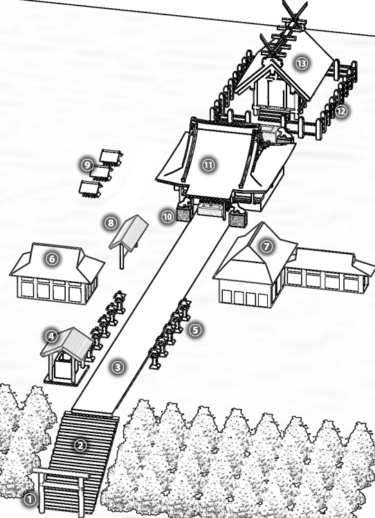
We walk past this almost without noticing, as if it were the most natural thing in the world. Considered plainly, though, it is a strange habit. Why have so many places been marked off with a boundary that no wall enforces?
This piece reads shrines not as objects of faith but as a medium for drawing lines on land. Follow the invisible boundaries, and something comes into view: a long human practice of projecting, onto space, a certain way of keeping distance from nature.
Let’s investigate.
Clue 1: The Boundary Grows Denser as You Go In
A border defended by a wall stops the body. A border defended by shared understanding stops the mind, and can hold ground that no wall could ever enclose.
Shrines vary enormously, and nothing said here fits all of them. With that stated plainly, start from what many of them share.
The idea of separating sacred space from ordinary space exists all over the world. Churches, mosques, and temples are examples, and so are the many gates and markers that signal a change in the character of a place. In East Asia, the hongsalmun gate before Korea’s royal tombs marks the approach to sacred ground. Drawing a line on land is not a Japanese invention.
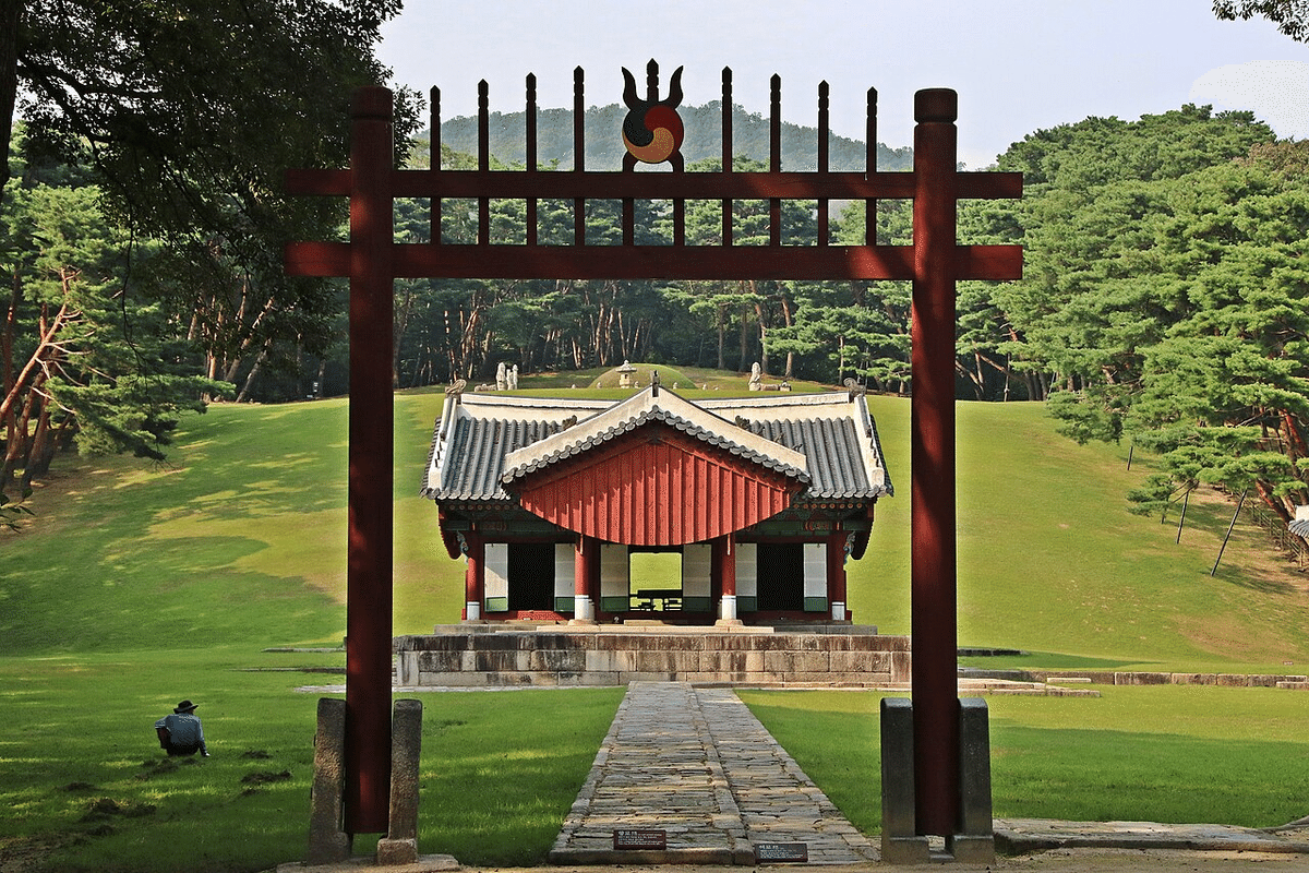
What is distinctive about the Japanese shrine is that its boundary is not a single line. It grows denser in stages as you move from outside to inside.
At the very outer edge stands a torii with no wall attached. Pass under it and you are already, by convention, in sacred ground. The same holds where a shimenawa, a sacred rope, is strung across a space. The rope is a single cord. It has no power whatsoever to physically stop anyone from entering.
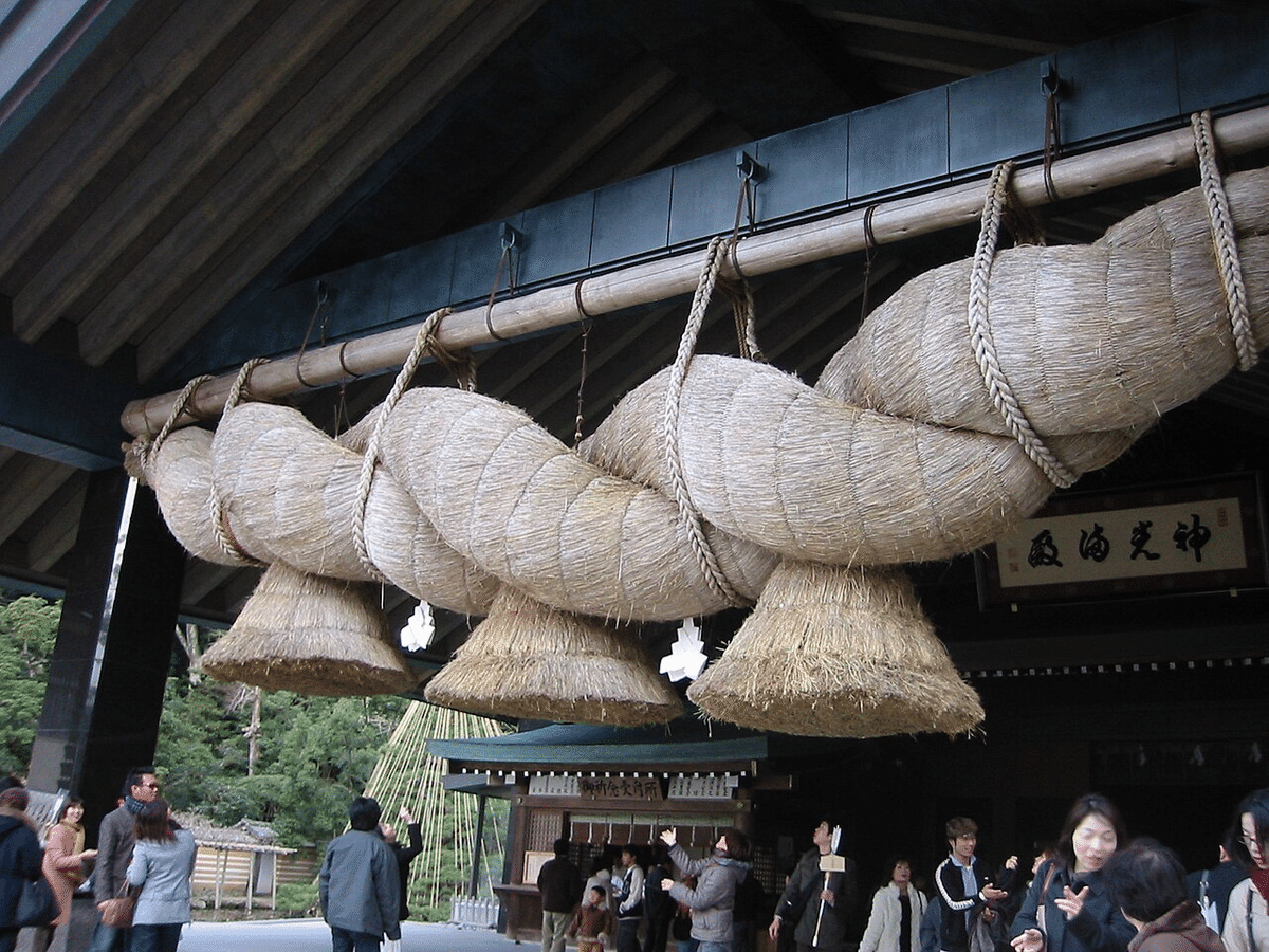
And yet people have understood, for centuries, that there is a line here not to be crossed. This invisible boundary is sometimes called a kekkai.
Move along the path inward, and the boundary becomes layered. At large shrines, after the first torii come a second and a third, gate after gate. Somewhere along the way is a water basin where visitors rinse their hands and mouth. Some shrines make you cross a bridge. The long approach, the successive gates, the cleansing with water: this whole sequence is a device for switching the mood of the outside world, step by step, into the mood of sacred ground.
Go further in, and the boundary begins to take physical form. Around the halls runs a fence called a tamagaki or mizugaki, and the innermost place, where the deity is said to dwell, is protected by a physical enclosure.
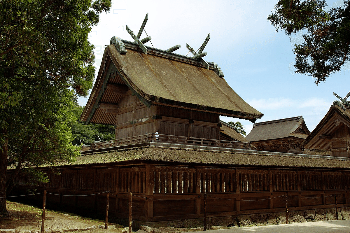
So the Japanese shrine has a structure that raises the density of its boundary by degrees, from an invisible outer edge to a solid inner wall. The striking part is that the outermost boundary is not a wall or a door, but a gate that anyone could walk around. How was such a boundary kept, with no wall to enforce it? Because it was held not by a wall but by a shared understanding among people. And the key to how people recognized that invisible line is the gate itself.
Clue 2: The Gate Without a Door
A marker does not need to block a path to divide it. It needs only to tell you that the ground on the other side is of a different kind, and to make you know it as you cross.
The torii is the shrine’s emblematic structure, yet look closely and it stands oddly.
A gate, one expects, has a door, with a wall running off to either side. The torii has neither. It is two pillars with a crossbeam laid over the top, and nothing more. You could ignore it and step around the side.
Which is the point. The torii does not physically halt passage with a door. Its main role is to serve as a marker announcing that beyond this point the space is of a different nature. The inner tamagaki fence physically encloses the sacred ground; the outermost torii, by contrast, plants a boundary inside human awareness. Through the act of passing under it, a person becomes sharply conscious of having crossed from the outer world into sacred ground.
This kind of marker-boundary is not unique to shrines. Stone pillars at national and regional borders, the dōsojin deities standing at the edge of a village: all exist to signal that a boundary is here, and the torii belongs, in the broad sense, to that same family.
So why did the outermost boundary of a shrine need to be a doorless gate rather than a wall? One reason, again, is that the sacred ground of a shrine was often a natural object. If a forest, a mountainside, a waterfall, or a huge rock is the sacred thing, enclosing it with a wall is frequently impractical. There may also have been a strong sense of incongruity in drawing a large artificial boundary around something to which humans were, by the very nature of the act, paying respect, along with real limits of materials and money.
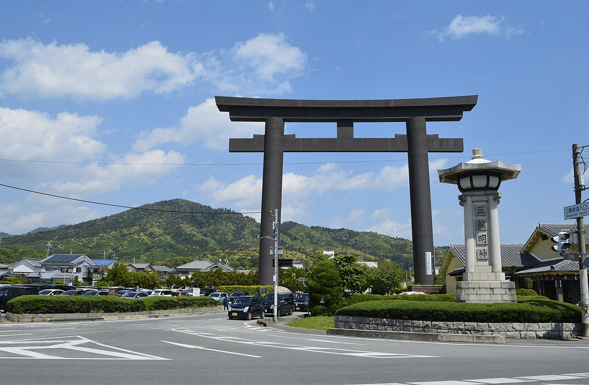
The Ōmiwa Shrine in Nara preserves this old form well. It has no main hall to house the deity. Instead, the mountain that rises behind it, Mount Miwa, is itself the sacred body, and worshippers gaze up at the mountain from the worship hall.
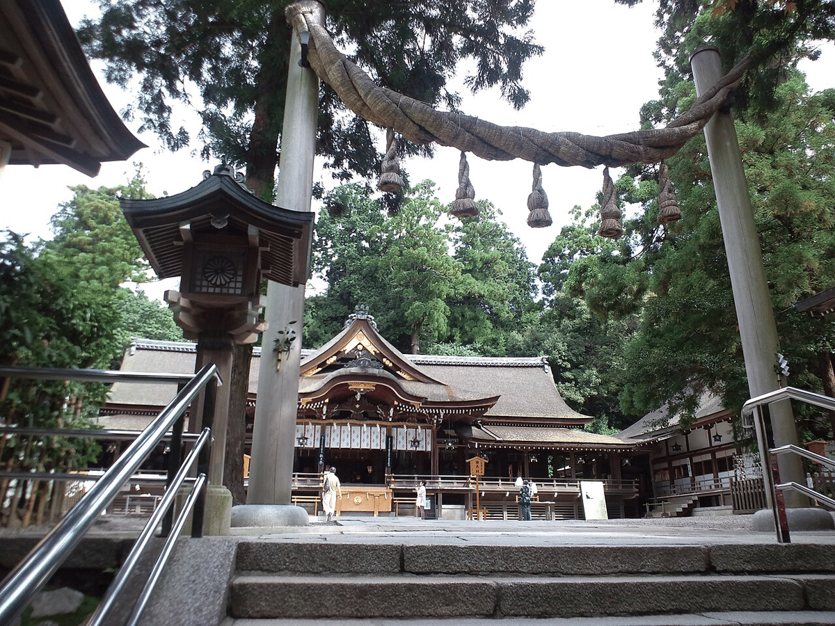
Behind the hall stands a distinctive triple torii, and beyond the fence that continues from it lies forbidden ground that no one may enter, holding three sacred rock formations on the mountain. When an entire mountain is the sacred ground, it cannot be shut inside a building, so a torii and a fence are placed at the entrance to mark that beyond this point the ground is of a different kind.
The same form appears at waterfalls. At the Hiryū Shrine, worshippers face the Nachi Falls directly as the sacred body, with no hall between them and the water.
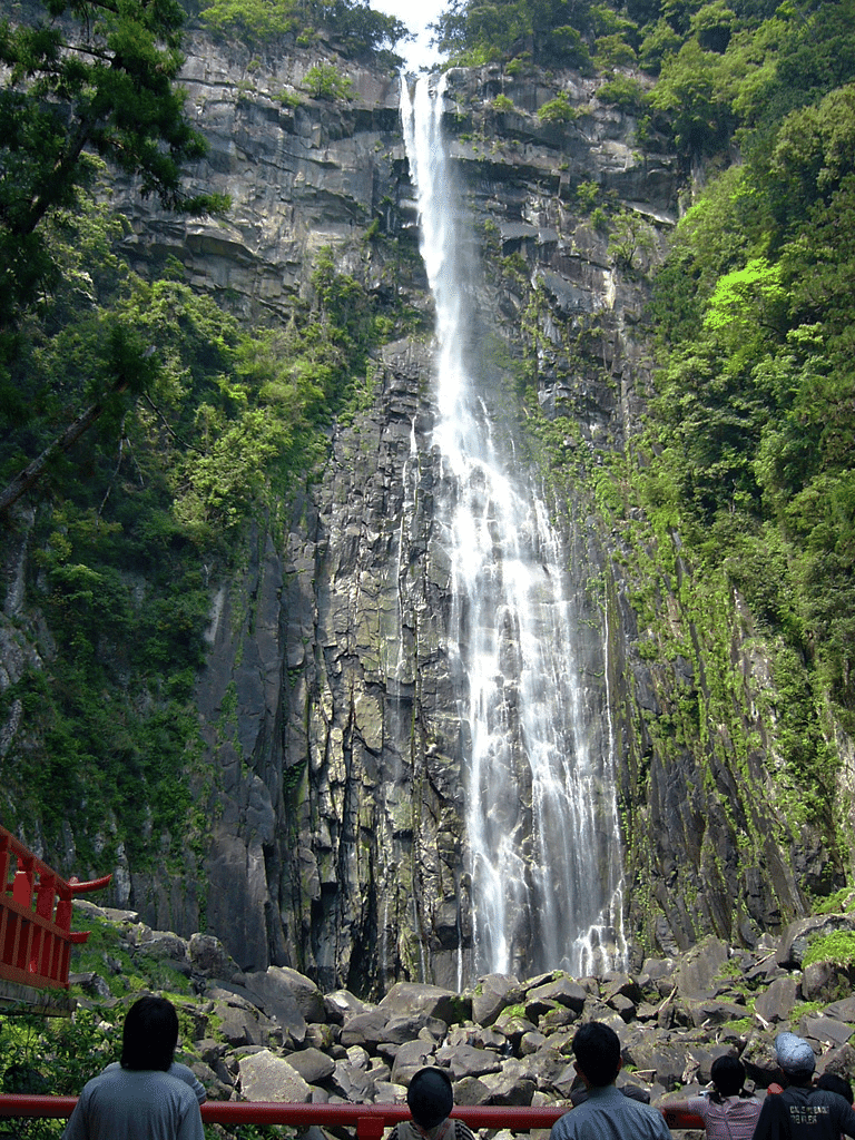
When a natural object becomes sacred ground, the boundary has been shown by the gate, the path, and the place of worship. This is why even a shrine with no main hall, one that treats a mountain or a natural object as its deity, still has a torii.
Looking at where shrines placed their sacred ground, the relationship with the land itself begins to appear.
Clue 3: Where the Line Was Drawn
Land that is feared is land that is left alone, and land left alone keeps, by accident, the shape and the memory that developed land erases.
Shrines often stand in places that carry some special geographic meaning. But reading their locations too strongly as expressions of a wisdom for interpreting land invites guesswork and projection, so this must be handled with care.
Consider first water. Many shrines sit at springs, waterfalls, or the headwaters of rivers, places tied to water. This may stem from how vital water was to life and farming. It cannot be concluded from this alone that people placed shrines in order to protect water sources, since the intentions of ancient people are hard to confirm from primary records. Yet it is also a fact that ground treated as sacred often escaped development and preserved forest and water in the process.
Mount Miwa, mentioned earlier, is one example. According to the shrine that worships it, entry to the mountain has long been strictly restricted as the dwelling of the deity. This sense of forbidden ground has kept the mountain from becoming a place people freely put their hands to. There is a real distinction here worth noting. A forbidden mountain is left as it is, while the managed woodland near a village, the satoyama, was precisely the ground people did work. It does not follow that the mountain was made forbidden in order to protect the forest. But the sense of prohibition did, in effect, leave the forest standing and worked in the direction of protecting the water source.
There is a real ecological point underneath this. Forests hold and regulate water, a function Japan’s forestry agency documents. A natural forest needs essentially no human hand to maintain itself, whereas a planted forest, once worked by people, requires continued management thereafter. The water-holding power of a neglected, poorly managed plantation drops sharply, and its fallen timber can even add to the destructive force of a debris flow. The grove that surrounds a shrine, the chinju no mori, can be seen as a natural forest that has survived to the present on the strength of awe.
Then there is disaster. Some shrine locations may be tied to it as well. Along the ria coast running from Sanriku down to Sendai Bay, the region has been struck by tsunami again and again through history: the Jōgan earthquake tsunami of the Heian period, the tsunamis of the Keichō and Tenpō eras, the Meiji and Shōwa Sanriku tsunamis, and the 2011 disaster. The memory of these waves has been carried down in the region’s lore and stone markers. In such places, disaster memory and shrines are sometimes spoken of together.
On the Sendai Plain, in the Wakabayashi ward of Sendai, stands a shrine called Namiwake. By the tradition handed down at the shrine, a great tsunami once reached this spot, and the waves divided in two before the shrine and drew back, which is said to be the origin of its name, “wave-dividing.”
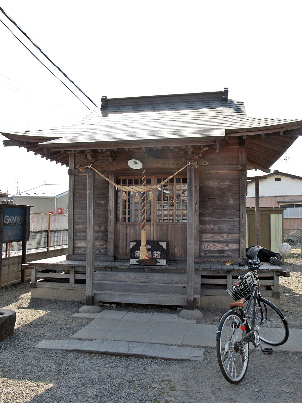
This is tradition, and it cannot be asserted as literal historical fact. Shrines founded on such origins, honored for having protected people from disaster, are found in various places.
There have also been attempts to examine this kind of tradition with data. A study published in the journal of the Japan Society of Civil Engineers, covering shrines mainly along the coast of Miyagi Prefecture and including the cities of Ōfunato and Rikuzentakata in Iwate, reported that of 215 sites surveyed, 139 escaped tsunami damage, 23 were partially flooded, and 53 were damaged. It further suggested that the pattern of damage seemed to differ by the deity enshrined or the shrine’s lineage. Shrines dedicated to deities such as Susanoo and Hachiman appeared relatively often among those that escaped, while some shrines dedicated to Inari and Amaterasu appeared among the damaged.
This must be read with heavy caution, and the study itself is careful about it. It covered a specific region, not the whole country, and does not transfer to shrines nationwide, whose natural conditions are entirely different. The study had methodological limits: the lineage of a shrine was in part inferred from its name, without strictly confirming which deity was actually enshrined. And above all, none of this makes “a shrine is safe” a basis for disaster planning. The result is also hard to interpret. It cannot be settled whether old shrines remain because they were built on safer ground to begin with, or whether shrines in dangerous places were repeatedly swept away or relocated by past disasters until the surviving arrangement was what we see now. Some shrines may have survived a disaster physically, only to fall into ruin later as their village thinned and its people scattered. And from 1906 onward, a government policy of shrine consolidation drove a wave of mergers and closures. The arrangement of shrines standing today is the result not of natural forces alone, but of whether human effort sustained them and of administrative consolidation.
Even so, the attempt is not meaningless, and something does come into view through it. On alluvial plains, old settlements sometimes formed on natural levees or slight rises standing a little above their surroundings.
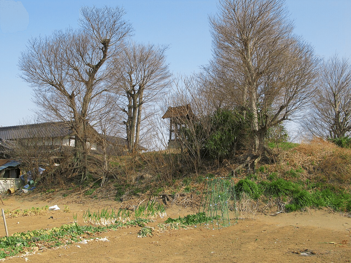
Shrines, too, were sometimes placed in such spots: within or around those settlements, on terraces, at the foot of hills, in places tied to the highs and lows of the land. In the position of an old shrine that has lived through a long span of time, information about elevation and the paths of water is sometimes, as a result, retained. Put another way, the boundary of sacred ground can end up touching the memory of the land. This is not to make any particular shrine a holy site, nor to say that going to a shrine wards off disaster. It is that, in some cases, long stretches of time have sifted the information of the land and preserved it in the form of where shrines and settlements stand.
Clue 4: Why It Took the Form of Faith
A reason can be forgotten in a generation. Awe can outlast the reason, which is its strength, and also, in the end, its weakness.
So far we have followed how the shrine’s boundary relates to the land. Now shift the angle. Faith is not the only way to preserve the memory of a place. Another is to carve it into writing.
In the hamlet of Aneyoshi in Iwate stands a single stone marker. The people there survived two near-total losses to tsunami, in 1896 and in 1933, moved their settlement to high ground, and set a stone at the point the water had reached, carved with the instruction not to build homes below it. In 2011, the water stopped below that stone, and not one building in the high-ground settlement that had kept the teaching was damaged.
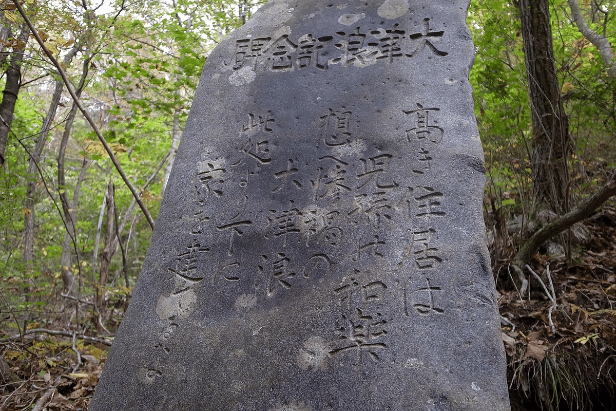
(I told the fuller story of that stone, and of the coast that made it necessary, in an earlier piece on Japan’s tsunami stones.)
The memory of a place has been carried in many forms: warnings cut into stone, traditions passed down in speech, festivals, and awe toward sacred ground. A community used several methods at once to make sure the memory of danger and boundary reached those who came after. The shrine is one of those forms. The reason “it is dangerous here, do not live here” tends to be forgotten across generations, but the awe of “this is the deity’s domain” can be handed down long, in a form separate from reasoning.
Awe has its own weakness, though. The concrete reason for the fear is gradually forgotten, and awe that has lost its reason is, in many cases, easily overridden by the turnover of generations or the pressure of development. Writing and awe each have strengths and weaknesses, which is exactly why leaving a warning through several methods makes sense.
The Verdict: The Line and the Hands That Keep It
Seen this way, the torii you meet on a street corner takes on a meaning different from a mere entrance to a religious facility.
The outermost torii is a gate without a door, and the sacred rope is a mark of a boundary that people have kept by shared understanding. The further in you go, the more the boundary takes the physical form of a fence, raising the density of the sacred. The Japanese shrine has drawn its boundary by degrees, from an invisible outer line to an inner enclosure.
And that boundary has been kept only through the work of people: repeating the yearly festival, sweeping the path clean, tending the shrine. Its lines and its locations are sometimes bound up with information about the highs and lows of the land and the paths of water. This was not designed for disaster prevention. It came about as a byproduct of a long practice of fearing nature and marking off sacred ground.
It is worth being clear about what this does and does not claim. It does not claim that shrines are hazard maps, or that the old placements are reliable enough to build on. The data on shrine survival is regional, partial, and open to more than one reading, and a boundary kept by awe fades the moment the awe does. The point is smaller and steadier than a miracle: over long spans of time, a practice meant for the deities happened, in places, to preserve real information about the land, and left it standing where a wall never could.
Geography is the record of survival strategy. In the invisible boundary line of a shrine, a fragment of that record is held.
Japan is one of the most geographically extreme places humans have ever settled: a chain of volcanic islands wracked by earthquakes, drenched by typhoons, and folded into mountains and narrow plains. And yet it became home to one of the world’s great civilizations.
How? The answer is geography, read closely.
Most writing about Japan looks at it from the outside. I read it from the inside, the way a geologist reads rock: as a record of forces, choices, and survival written into the land.
I’m a Strategic Geography Advisor based in Japan, and this newsletter is a field guide to the country’s hidden geography, the logic that placed its ancient capitals, shaped its food, and taught its people to live with a restless land.
Most essays are free.
Geography is the record of survival strategy. Let’s read it together.
—
Issei Takinami is a Strategic Geography Advisor and author of several bestselling geography books in Japan, including 『面白すぎる地理の話』 (The Fascinating Stories of Geography, Sangyo Henshu Center, 2026). He serves as Representative Director of the Institute for Japan Regional Geography (IJRG).