
The Village That Shouldn’t Be There
Kitayama, Japan’s Only Exclave Village

The records don’t say who drew this border. The river shows why Kitayama faced Shingu.
Open a map of Wakayama Prefecture, on the Kii Peninsula south of Osaka, and look along its eastern edge.
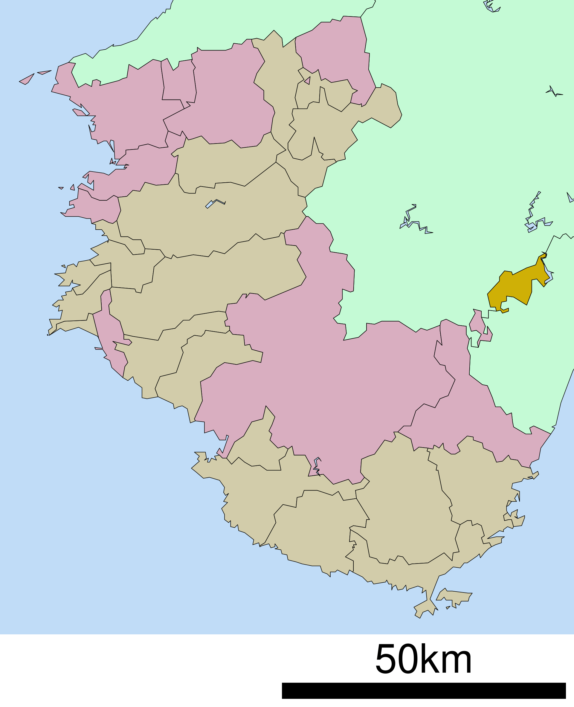
There is a patch of Wakayama, about 48 square kilometres of steep forest, that is not attached to Wakayama. It sits inside other prefectures: Mie to the east, Nara to the north and west. It touches its own prefecture at no point. To drive from this piece of Wakayama to the rest of Wakayama, you have to leave the prefecture first, cross into Nara or Mie, and come back out again.
The village is called Kitayama. Fewer than four hundred people live there, and it is the only municipality in Japan whose entire territory is stranded outside the rest of its prefecture. Detached scraps of land are common enough; a field ends up on the wrong side of a shifting river, a hamlet on the wrong side of a merger. Wakayama has a second one close by, a fragment of the city of Shingu. What sets Kitayama apart is that the whole village is on the wrong side of the line.
Borders are supposed to follow something you can see. A ridge, a watershed, the river. This one follows none of them. So who drew it, and why here?
Here is the strange part: nobody can say for certain. The village will tell you its own ancestors asked for this. What nobody disputes is which way the village was looking, and to see that, you have to stop looking at the land and look at the river.
What the village had
Kitayama runs about twenty kilometres east to west and eight north to south, and almost all of it is forest. The flat ground is a thin ribbon along the water, and there is very little farmland, too little to feed the village by farming. Whatever it lived on, the mountains would have to provide.
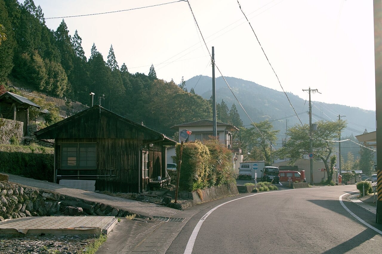
What the mountains produced instead was cedar, and very good cedar. In the Edo period the district was administered as part of the Shingu holding of the Kii domain, one of the three senior Tokugawa houses, and the domain valued the timber accordingly.
So the village had one asset and one problem. The asset was standing all around it. The problem was getting it to a buyer.
Until the modern highways came, the only way into Kitayama was a narrow mountain path, and Japanese writers called the place a hikyō, somewhere beyond the roads. A path like that will carry a person. It will not carry cedar in any quantity. As Wakayama’s own heritage service puts it, in the age before trucks the way to move timber was the raft.
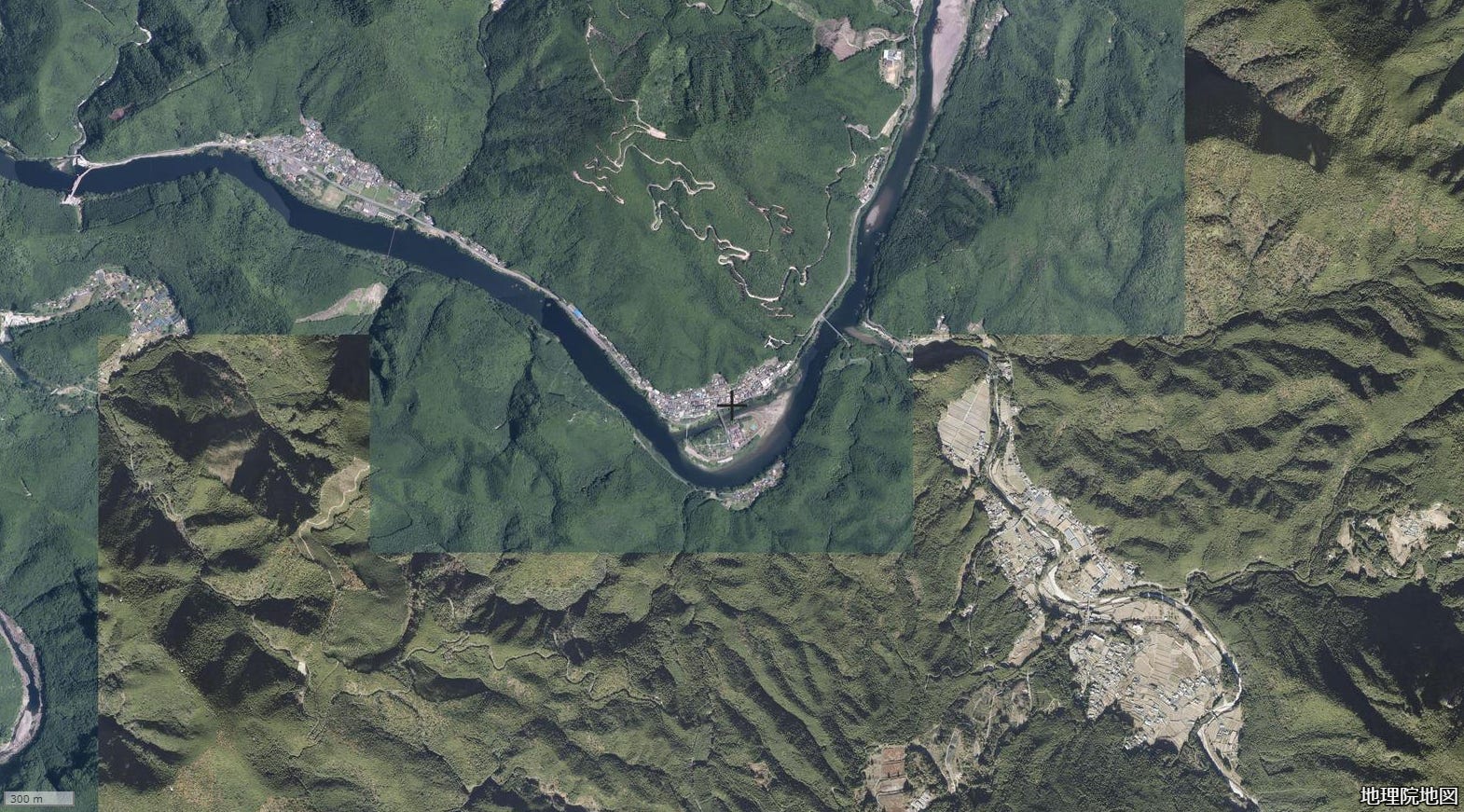
So the village put its trees in the water. The Kitayama River runs through the settlements and then south, gathering the drainage of the range, until it joins the Kumano River. The Kumano reaches the sea at Shingu, a port on the Wakayama coast, and Shingu was where the timber of the whole region was collected and sold.
The river road
Look at the map again, and this time ignore the borders. Trace the water.
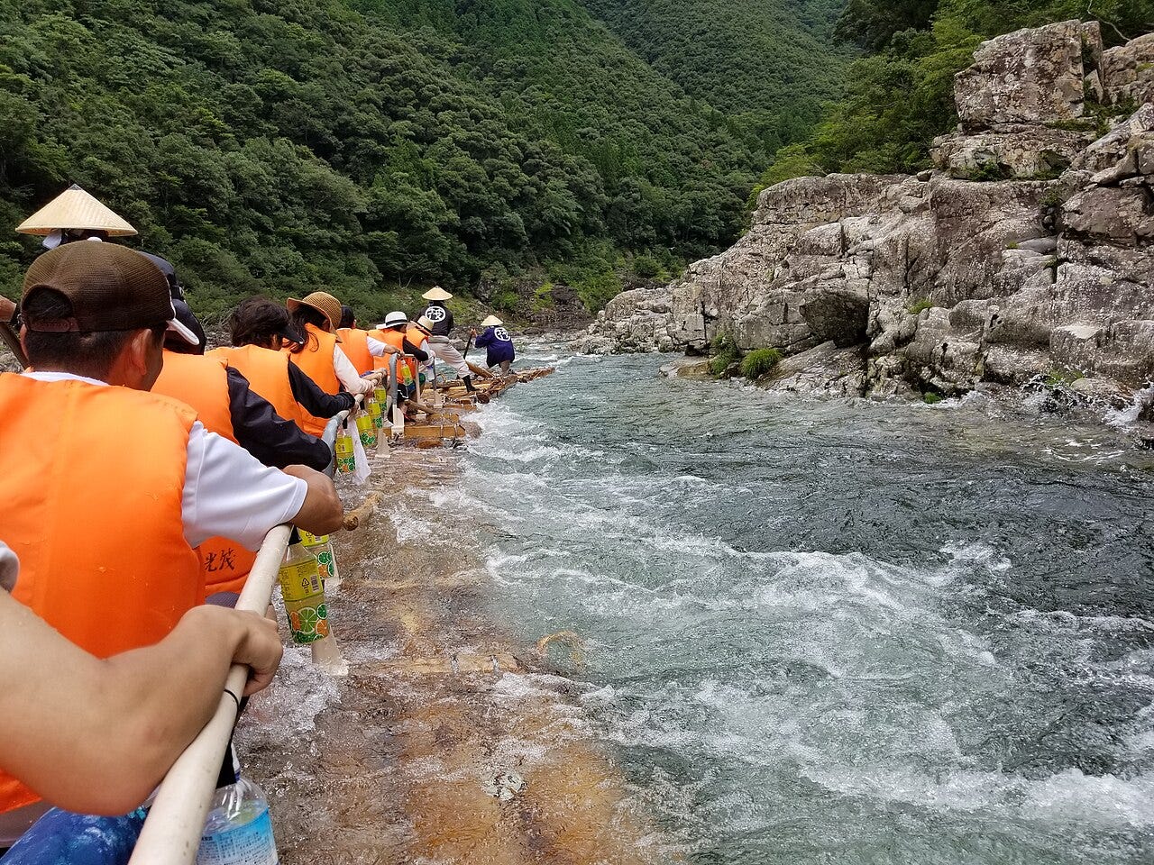
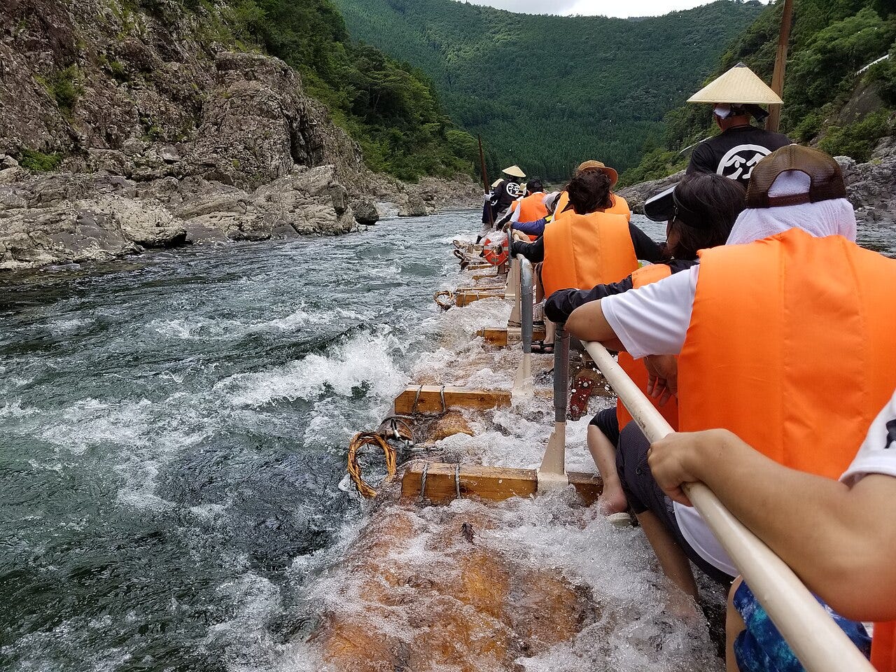
Rafting on this river system goes back, by the Japanese Forest Society’s reckoning, to around the sixteenth century, and the method that reached living memory is easy to picture. Cedar logs were lashed into a section of eight, called a toko, and seven sections were coupled into a train of timber some thirty metres long. The raftsmen stood on top and worked it down the rapids with oars.
At the peak there were several hundred of them in Kitayama alone. By the village’s own account raftsmen made up much of its working population, and they and the timber merchants of Shingu could not do without each other.
You can hear how dangerous it was in the name of the worst stretch of water. Wakayama’s heritage service calls Otonori the hardest point on the run, and gives the local reading of the name: oto-nori, the younger brother rides. The eldest son, the one who would inherit, was kept off that raft. It is the kind of calculation a village makes when the same river is both its livelihood and its danger.
Then, at Shingu, the crews sold the timber, bought what the village could not make for itself, and walked home. They went back up over the ridges, on paths that climbed out of the gorge and ran along the tops, and the village keeps those paths cleared today under the name they always had: the Raftsmen’s Road.
So the timber went down the river and the men came back over the mountains. Which means Kitayama’s neighbours on the map were not its neighbours in trade. Its main documented trading connection ran downstream to Shingu, on the coast of what would become Wakayama.
The border question
In 1871 the Meiji government abolished the old domains and started assembling prefectures out of the pieces. Shingu went to Wakayama. Kitayama went to Wakayama too, though it touched nothing else Wakayama owned. How that was arranged, no record explains, and two stories have grown up in its place.
The first is the village’s own. Its history says that when the men of Kitayama heard Shingu had gone to Wakayama, they asked to go with it.
The second comes from the superintendent of the village’s board of education, passed down as local talk. Alongside the story about the petition, he told a local paper, there is another: that the officials who drew the boundaries divided the country by mountains and valleys, and overlooked Kitayama entirely.
Wakayama’s official history, published in 1989, refuses to choose. The surviving records, it says, do not establish the direct cause. And it gets murkier before it gets clearer. A map from 1881 shows Kitayama inside Mie; a map from 1887 shows it inside Wakayama. The village offers the pair as a reason to think the matter was settled later than 1871. The two sheets raise the question without answering it.
Three different questions hide inside this one, and they have very different answers. How the exclave was made is the first, and it is the one genuinely lost. Why Wakayama rather than Nara is the second, and it is not lost at all. And why the village is still an exclave today is the third, which turns out to have almost nothing to do with the other two.
Take the second, because it is the one the sources can answer. Whichever of the two stories is true, notice what none of them even considers: that a place whose timber and money ran down the river to Shingu might instead be handed up the mountain to Nara. The standard reference on Japanese place names records the reason in flat words: the district had belonged to Shingu under the old domain, and the raft trade bound it to the river’s mouth. The record does not tell us who drew the line. The river shows why the Wakayama connection made sense.
The third question we can hold for a moment, because in 1889 five hamlets were combined into the village of Kitayama, and it has never merged with anything since. That turns out to matter more than any of the border stories.
After the rafts
The rafts outlived the war. The Forest Society’s record has about a hundred raft trains a day still running afterwards, feeding the reconstruction downstream.
Roads, trucks and large dams then displaced timber rafting across Japan, and on the Kitayama system the last commercial raft ran in May 1963.
The border did not move. But the trade that had linked Kitayama to Shingu for centuries was gone, and the village went on shrinking without it.
Then, in 1979, the raft came back, repurposed. The village restarted the descent for tourists, and to do it, it had to work with the dams that had helped displace it. The rafts were registered as small vessels. The dam operators were asked to release water on a schedule, so the river would be running when the passengers arrived. And the men who had steered the last working rafts were brought back to steer the first tourist ones.
The old rafts ran on whatever water the river gave them. The new ones run on water the dam lets out to a timetable. The dams that helped displace commercial rafting now release the water that keeps its tourist successor running.
It works, after a fashion. The descent is the only one of its kind in Japan, running May to September, and the village reports about seven thousand passengers a year. Wakayama’s tourism service puts the number of raftsmen at sixteen; in the off season they are the same men working the orchards and the water supply. In 2017 the prefecture made the technique an intangible folk cultural property, and the Japanese Forest Society has since listed it as a national Forestry Heritage, the first in Wakayama.
The orchards those sixteen men work in winter are the village’s other survival strategy, and it came close to being shut down.
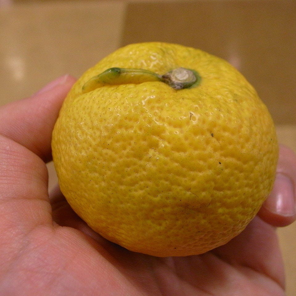
It began with one man and one tree. In the 1970s a villager took an interest in a sour citrus growing wild on his land, a fruit that turned out to exist nowhere else. He grafted it, propagated it, and pressed the village to take it up. It did. And for close to thirty years, it lost money.
The fruit, called jabara, was a hard thing to sell: too sour to eat, unknown outside the valley, and handled by a village with no sales network to speak of. The harvests came in and the stock piled up. Eventually the village set a limit: two more years, and if nothing changed, the trees would come down and the business would close.
The turnaround began with one customer’s answer. A buyer at the other end of the country had been ordering the stuff in bulk, year after year, and when a village official finally asked why, the reason was hay fever: the usual medicine caused drowsiness, and jabara was being taken instead. The village ran a monitor survey; of 660 valid responses, 303, close to half, reported some relief from their symptoms. The prefecture’s industrial research centre found that jabara was unusually rich in a flavonoid called narirutin, a fact about the fruit’s composition rather than a clinical result. The village put the survey at the front of its marketing and, in 2001, opened a storefront on Rakuten, then a fast-growing online mall. By its own account it was the first local government to do so. The citrus the village had been ready to fell became one of its core industries.
None of it has reversed the decline. Fewer than four hundred people are left, and the sixteen men on the rafts in summer are the orchard and waterworks crew in winter. A survival strategy is not the same thing as a recovery. It is what a place does instead of disappearing.
The map keeps score of all this in small ways. Until the end of October 2008, Kitayama’s postal code began 519, a Mie series, while Wakayama’s run in the 640s; the village was reassigned to 647-16 only that November. The bus still runs to a railway station in Mie, and the better roads have put Wakayama City, Osaka and Nagoya each within about three hours by car. Kitayama’s transport links eastward have grown stronger. The trade route that once made the border intelligible has been gone for sixty years. The border has not.
What a strange border is telling you
Most famous enclaves can be traced through paper. Somebody won a war, signed a treaty, split an estate, and the documents outlived the people.
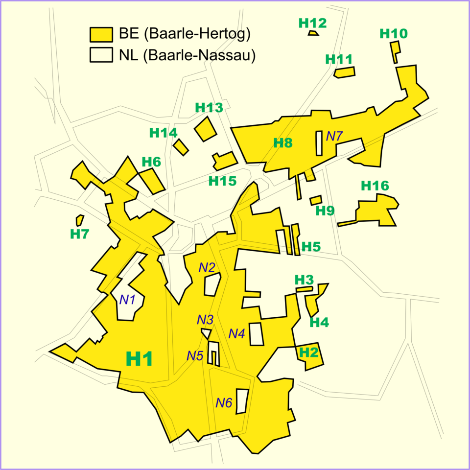
Europe’s best-known example works exactly that way. At Baarle, on the Belgian-Dutch border, twenty-two Belgian parcels sit inside the Netherlands, with Dutch parcels inside some of them, in a mosaic that goes back to medieval land deals between the lords of Breda and the dukes of Brabant. It was carried forward into modern land records rather than tidied away, and the boundary can be reconstructed from them.
At Kitayama those records are missing, and the river cannot hand them over. What it can do is show you the world the decision was made in.
Because a border is not a photograph of the present. It is a deposit. The terrain made some journeys cheap and others dear, the timber made Shingu the market that mattered, and the old domain had already filed the district under Shingu. Those conditions are why the village faced Wakayama. The line itself was set in the 1870s, and it held. Then the roads came, the village’s connections shifted towards Mie, and the border stayed where it was. A line does not follow the traffic. It is drawn once, in the world that exists at the time, and it goes on holding that shape long after the world has moved.
So when you find a border in your own country that looks like a mistake, the question to ask is not which mountain it failed to follow. It is what used to move through there, and who was making decisions while it moved.
The village that stayed
You can still ride the rafts, May to September, on water let out of the dam on a schedule, through Otonori, the rapid whose name recalls the old rule about who was kept off the logs.
Stand on the timber and the strange map gets easier to read. Cedar could not cross these ridges in quantity. It could float down this river, and the river ran to Shingu. That is why the village faced the way it did, and it is the one part of this border the record can explain.
And it points to the answer to the third question, the one the border stories never reach. The nineteenth-century border was inherited. Later generations chose how to keep a municipality functioning inside it: they revived the rafts, they persisted with jabara, and when Japan merged its small municipalities in the 2000s and every other village in Wakayama joined a larger town, they refused to merge, and remained the only village the prefecture has left. None of those choices moved the line. They kept Kitayama viable within it.
The border outlived the river trade that once made it intelligible. What the village keeps choosing is how to live after the trade was gone.
Geography is the record of survival strategy.
Japan is one of the most geographically extreme places humans have ever settled: a chain of volcanic islands wracked by earthquakes, drenched by typhoons, and folded into mountains and narrow plains. And yet it became home to one of the world’s great civilizations.
How? The answer is geography, read closely.
Most writing about Japan looks at it from the outside. I read it from the inside, the way a geologist reads rock: as a record of forces, choices, and survival written into the land.
I’m a Strategic Geography Advisor based in Japan, and this newsletter is a field guide to the country’s hidden geography, the logic that placed its ancient capitals, shaped its food, and taught its people to live with a restless land.
Most essays are free.
Geography is the record of survival strategy. Let’s read it together.
—
Issei Takinami is a Strategic Geography Advisor and author of several bestselling geography books in Japan, including 『面白すぎる地理の話』 (The Fascinating Stories of Geography, Sangyo Henshu Center, 2026). He serves as Representative Director of the Institute for Japan Regional Geography (IJRG).